The Great Canadian Cycling Adventure
Across Canada by Bicycle in the Tour du Canada 2000
Welcome > Coast Mountains > Over the Rockies
Coast Mountains: Vancouver BC to Sicamous BC
Day
1: Vancouver to Mission, BC
June 29, 2000
"Every
journey begins with a single step"
Once again I'm up pretty early -- well before I need to be. It's a combination of excitement and time zone dislocation. We all gather for a cold breakfast out of the truck at 7:00 a.m., and everyone checks out of the UBC residence and loads everything into the truck. After breakfast cleanup, it's time to go!
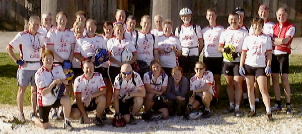
Back
row L-R: Neri, Herb, Jeff, Daphne, Eric, Robert, Sue, Carol, Bruce, John, Jon,
Bliss, Isabelle, Keith, Karl, Jules, Craig, Kelly, Alan, Bruce
Front row L-R: Catherine, Ron, Dave, Karin, Brook, Tacia
At
8 am we ride over to the UBC Museum of Anthropology for group and individual
pictures with the totem poles. Tour
organizer Bud, his partner Margot and our driver Brook play
photographers, taking each person's camera
in turn and snapping a picture with it. Everyone
gets a picture on their own camera, and as you might imagine, it takes a while. Then
it's off down the hill at 50+ km/hr to Jericho Beach where we do the ceremonial
"dip the wheel in the ocean".
One
of the Vancouver riders from TDC '92 has shown up to lead us out of Vancouver.
This is a blessing since he knows a bike-friendly route.
This allows us to get through downtown Vancouver and out towards the
Lougheed highway in good time. As
our group cycles along the streets, all wearing our brand new Tour du Canada
jerseys, people stop to look. When
we pass one corner, John tells a group of people that we're a parade, and they
ought to be clapping, at which point we get a round of applause.
Several
of the group decide to stop at Mountain Equipment Co-op for some last minute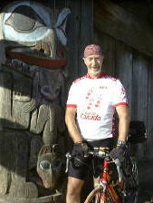 camping shopping, and a couple more stop at a coffee shop. I find myself with Jules, an Ottawa native relocated to
Boston by Nortel. Jules is a strong
rider and I hang on for the ride. I'm
thinking that this is faster than I want to go, but what the heck. I've got first-day energy to burn, and so does Jules.
It feels good to be on the road and moving.
The route out of Vancouver is easy to follow on the map, with not too
many hills except around Burnaby Mountain.
The traffic is pretty heavy though, and with the sun beating on the
pavement, it's hot and smelly with all the traffic fumes.
camping shopping, and a couple more stop at a coffee shop. I find myself with Jules, an Ottawa native relocated to
Boston by Nortel. Jules is a strong
rider and I hang on for the ride. I'm
thinking that this is faster than I want to go, but what the heck. I've got first-day energy to burn, and so does Jules.
It feels good to be on the road and moving.
The route out of Vancouver is easy to follow on the map, with not too
many hills except around Burnaby Mountain.
The traffic is pretty heavy though, and with the sun beating on the
pavement, it's hot and smelly with all the traffic fumes.
From
Vancouver we pass through Burnaby, Port Moody, and Coquitlam along the lower arm
of the Burrard Inlet as it reaches inland.
Then we pass through Port Coquitlam, over the Pitt River and along
highway 7, now following the Fraser River.
The river is in full flow, fast and heavily laden with silt.
As we pass through Albion and Haney we pass several riverside lumber
operations, and the smell of red cedar perfumes the air.
About
5 km past Silverade, Jules and I think we should have reached the turnoff to the
camp, but we haven't. Wondering
whether we've missed the turn back in Silverade, we double back and ask at the gas
station. We're told to keep going
where we were going. Retracing our
route down the highway, we discover that the turnoff is about 100m past where we
turned back before! Well, there's
an extra 10 km we
didn't need to do!
Arriving
in camp at 12:30 p.m., we discover three things:
1. We're way too early - nobody else is there; 2. Since the truck isn't
there yet, none of our stuff is either, so there's nothing we can do.
And, 3, there's no point in beating the truck to camp.
We decided to finish our lunch that we started at Silverade when we
doubled back. The remainder of the PBJ (peanut butter and jam) sandwiches and
bananas disappear quickly.
There's a community room in the camp and we find a couple of pool tables.
After three games, Jules beating me two to one, we go outside to find
Tacia, Jeff, Kelly and Craig arriving. In
the briefing the day before, Bud had highlighted an archeological site worth
visiting just down the road past Mission. Tacia
decides to stay behind, and the rest of us hit the road to Hatzic.
The
story of Hatzic is that during some construction, remnants of an old dwelling
were uncovered. One of the
construction crew members, a Native Canadian, recognized the value of the
discovery, and after a land swap to preserve the site from construction, the site was excavated.
The site today features a rebuilt Indian longhouse, and on display are
tools, domestic items, and fishing and hunting artifacts.
It's well worth a visit.
Returning
to camp, we get separated, with Jules and Kelly lagging behind.
Jules flats, but tells Kelly he's okay to fix it, and Kelly rides on.
Meanwhile we've lost site of them, so stop to let them catch up.
Kelly arrives and tells us that Jules will meet us at the Dairy Queen, so
off we go for a frosty treat. Jules
never shows up, so we decide to cycle back to look for him, and he runs into us
a few minutes later. It turns out
that his spare tube didn't fit, so he had to patch his tire, and then his pump
didn't work worth a darn. The
result is that we end up finding a bicycle store so Jules can get outfitted, and
so Craig can spend some more money and get even more over budget.
We arrive back at camp to find the camp fully established and dinner preparations underway, just as it starts to rain lightly. It does let up enough to allow us to eat and clean up the dinner things. Cooking for 24 hungry cyclists will take a little getting used to. What looked like lots turns out not to be, and a second batch of pasta and sauce is required. We'll discover as we go along that thinking in terms of 40 to 50 regular servings will be about right.
The rain picks up through the evening, and by 8:00 p.m. the rain seems to
have settled in for the night. Here
we are: Day 1, and we're already cooking and eating dinner in the rain.
With not a lot of shelter, once dinner's over there isn't much to do
except disappear into our individual tents, making for an early evening.
Reflecting on the day, I realize this is a fun group. Karl has a little stuffed dog called Sparky mounted on his handlebars. Bliss, riding with us as far as Calgary, has a Marge Simpson doll mounted on his rear rack, watching the approaching traffic. Kelly has a stuffed animal - Adventure Bear - riding her rear pannier. And so the contest is on to adopt little pets to ride with us. As Karl says, when the going seems tough, you look down at this little stuffed animal, and you just can't take things too seriously.
As
I sit in my tent writing this, the rain is getting heavier and heavier.
This is a tad depressing. It's
not particularly cold rain, and cycling in the rain isn't a problem, but it's hard to get dry
and stay warm when pitching and breaking camp every day, and needing to rinse
out or wash cycling clothes each night. Packing
up a wet tent means that it comes out wet later that same day.
And gradually everything in my camp bag gets wet -- pillows, sleeping
bag, and so on. Not fun.
Oh
well! This is certainly nowhere
near as bad as it could be. That
day will be the one we arrive in camp after riding 175 km in cold rain against
headwinds, to find the campground a sea of mud, and then have to set up camp in
it. And even that isn't as bad as
it might be. I could be at work for
the summer, instead of out here!
Something else caught my attention today. Whenever we stopped to ask directions, and when we went into the Hatzic site, the bicycle shop and the Dairy Queen, people noticed our Tour du Canada jerseys and asked us who we are and what we're up to. When we explain, we get lots more questions. People are friendly, curious, and captivated by our quest.
The
first step’s taken, the journey begun.
Rain or not, this is fun!
Daily
Stats:
Day temp: 20C Wind:
E, light
Official distance: 75km Distance
actually cycled: 107km
Elevation: 0 to about 100m at highest; campground at 13m.
..alan
Sun Valley Trout Park
Mission BC
Day
2: Mission to Hope, BC
"Nothing great was ever achieved without enthusiasm" Ralph Waldo Emerson
After
the rain last night, this morning dawns leaden gray, damp and chilly.
Packing up a wet tent is no fun, and we simply hope that we'll be able to
dry stuff out in Hope, our next stop. After
a filling breakfast of porridge with raisins and coconut, and a banana, and with
two thick PBJ's and two bananas packed for lunch, I hit the road at 8:00 a.m.
My bike's a little heavier this morning -- given the look of the sky, I
take along my wet weather and cold weather cycling clothes in a trunk pack
attached to a rear carrier. I also pack two full water
bottles (24 oz each) and my Camelback (72 oz) with Gatorade mix for hydration
along the way. I've learned in
training that I need about 1 oz per km, and more in hot weather.
All of this adds a lot of weight to carry along.
I
start out alone and cycling at an easy pace this morning, knowing that there are some slower riders
ahead of me, and some faster behind. This
will let me find my pace and then tag on with a few others riding about the same
pace.
Traffic
on hwy 7 running through Mission and east along the Fraser Valley is fairly
heavy, but the shoulders are paved and generally pretty wide.
After about 30km, Jules and Jon catch up to me, and we continue together.
Not long after, we catch up to a slower and early group of about five who
left camp about half an hour earlier. 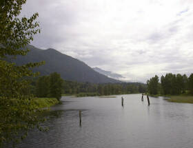 The
cold damp of last night is quickly forgotten as we spin along the Fraser Valley.
The valley floor is dead flat, so is the road, and there's very little
wind, allowing us to spin along at 30 to 35 km/hr.
Occasionally we stop to take pictures (picture left: view from Nokomen
Island bridge).
The valley is noticeably narrowing as we move up the river, the mountains
starting to crowd in on either side. These
are the lesser interior ranges of the Coast Mountains, somewhat blunted, well
forested, and truly majestic with their peaks wreathed in cloud.
The
cold damp of last night is quickly forgotten as we spin along the Fraser Valley.
The valley floor is dead flat, so is the road, and there's very little
wind, allowing us to spin along at 30 to 35 km/hr.
Occasionally we stop to take pictures (picture left: view from Nokomen
Island bridge).
The valley is noticeably narrowing as we move up the river, the mountains
starting to crowd in on either side. These
are the lesser interior ranges of the Coast Mountains, somewhat blunted, well
forested, and truly majestic with their peaks wreathed in cloud.
Just
outside Agassiz (picture below right), Jon, Jules and I stop at a gas station restaurant for a break.
Coffee and a hot cinnamon bun, along with the obligatory banana, never
tasted so good. With two or three
bananas during each day's ride, and one at breakfast, I'm going to eat one pile
of them over the next two months. While
stopped we see the group we passed earlier round the bend and head on for Hope.
We decide to take a side trip to the "famous" Harrison Hot
Springs. 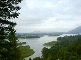 Harrison BC lies at the
south end of 40km long Harrison Lake. Harrison is about 6 km off our route and we're there quickly.
The
lake turns out to be nestled by mountains and is truly beautiful setting. Following a path along the lakeshore for a few hundred meters, we
discover the "hot springs", and they're disappointing.
Instead of a boiling, bubbling, steamy sulphurous pool, we find a little
concrete block building, covered with graffiti, "protecting" people
from the 75ºC water. The water is
piped into town, cooled to 38ºC, and distributed to a public pool and to a
couple of hotels for pools and Roman baths.
Oh well! By now a group of
about 10 others have arrived in town, and we take some time to look around some
shops and have our first lunch of the day (PBJ and banana).
Harrison BC lies at the
south end of 40km long Harrison Lake. Harrison is about 6 km off our route and we're there quickly.
The
lake turns out to be nestled by mountains and is truly beautiful setting. Following a path along the lakeshore for a few hundred meters, we
discover the "hot springs", and they're disappointing.
Instead of a boiling, bubbling, steamy sulphurous pool, we find a little
concrete block building, covered with graffiti, "protecting" people
from the 75ºC water. The water is
piped into town, cooled to 38ºC, and distributed to a public pool and to a
couple of hotels for pools and Roman baths.
Oh well! By now a group of
about 10 others have arrived in town, and we take some time to look around some
shops and have our first lunch of the day (PBJ and banana).
Heading
back down the road, we pick up the main highway and continue on our way to Hope.
We start to encounter some hills as the highway rounds the odd mountain
spur. The river is by our side the
entire way, usually down a cliff or heavily wooded bank.
After Lake Errock (picture left), where we stop for more picture-taking, we start a
series of low-grade climbs and gentle drops, 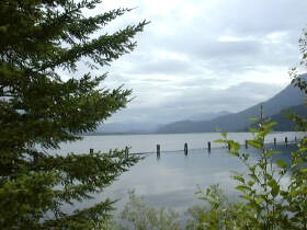 ending up climbing about 150m above
the river level. Getting closer to
Hope, we pass a highway sign that warns of an 11% downhill grade ahead, with curves.
I quickly pick up speed going down, and I'm a tad worried as I don't yet
know and trust my bike's balance with
the added weight on my rear carrier. I've
got a cantilevered rack mounted on the seat-post with a trunk bag on top and my
raingear bag underneath it. This
puts a few kilograms of extra weight at the height of my hips -- too high and
too heavy for my liking. Yet around
the first 40º turn at about 60 km/hr the bike seems wonderfully stable, so I
decide to let 'er rip. Spinning up
to about 120 rpm, I then tuck out of the wind as much as possible and simply let
gravity do what it does best. What
a ride! At the bottom of the hill,
spinning along the flats again, I check my GPS and cyclometer. One reads out a max speed of 84.6 km/hr and the other reads
out 80.1 km/hr. Either way, that's
the fastest this boy's ever ridden a bicycle!
And to think, people pay good money for thrills like this at Wonderland!
ending up climbing about 150m above
the river level. Getting closer to
Hope, we pass a highway sign that warns of an 11% downhill grade ahead, with curves.
I quickly pick up speed going down, and I'm a tad worried as I don't yet
know and trust my bike's balance with
the added weight on my rear carrier. I've
got a cantilevered rack mounted on the seat-post with a trunk bag on top and my
raingear bag underneath it. This
puts a few kilograms of extra weight at the height of my hips -- too high and
too heavy for my liking. Yet around
the first 40º turn at about 60 km/hr the bike seems wonderfully stable, so I
decide to let 'er rip. Spinning up
to about 120 rpm, I then tuck out of the wind as much as possible and simply let
gravity do what it does best. What
a ride! At the bottom of the hill,
spinning along the flats again, I check my GPS and cyclometer. One reads out a max speed of 84.6 km/hr and the other reads
out 80.1 km/hr. Either way, that's
the fastest this boy's ever ridden a bicycle!
And to think, people pay good money for thrills like this at Wonderland!
Climbing
another grade for about a kilometer, we stop at the top to take some pictures
and eat our second lunch (another PBJ and banana). On the final stretch towards Hope, we zip along a straight
flat highway with a 25 km/hr tailwind and we're spinning along at 40 to 45 km/hr
for most of it. Entering Hope, we
stop to take a picture of the town sign which proclaims the town to be the
"Chainsaw Carving Capital" (picture at right). 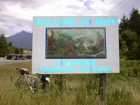 Camp
is well established when we ride in -- the truck is open, the early group is
setting up their tents, and it's windy and warm.
Camp
is well established when we ride in -- the truck is open, the early group is
setting up their tents, and it's windy and warm.
I
find a great place to pitch my tent on the edge of the bank of the Fraser River,
among some huge pines with meter-diameter trunks. What a great setting. Setting
up my dripping tent, it starts to dry quickly, as do yesterday's still
wet-from-washing clothes when hung on a line. After
a quick shower, and washing out today's cycling clothes and hanging them to dry,
it's off with a small group to explore the town, buy some postcards, and visit
the Dairy Queen. This is day 2, and
the second Dairy Queen day in a row. This
could become a habit!
While
at the Dairy Queen, we encounter a group of about 8 cyclists, members of the BC
Randonneurs. Randonneurs are
cyclists who specialize in extreme distances in small amounts of time.
This group was just taking a break before starting their last 80 km of a
2,000 km trip, done in six days! That's
over 300 km a day. One day they
were on the road for 20 hours. I
think these folks are crazy, but I guess that's what others think about those
who cycle across Canada too!
Back
at camp, I spend some time before dinner sorting out clothes and gear for
tomorrow morning. Then we all sit
down to a dinner of salad, pasta and a great mushroom-tomato sauce.
 We're going to be
eating a lot of pasta, salad and beans on this trip,
but the calories are surely needed. We're
also discovering that cooking for 24 hungry cyclists is like cooking for 50 --
we're each eating about double what we normally would.
We're going to be
eating a lot of pasta, salad and beans on this trip,
but the calories are surely needed. We're
also discovering that cooking for 24 hungry cyclists is like cooking for 50 --
we're each eating about double what we normally would.
As
I finish this journal entry for today, it's still quite light at 9:20 p.m., the
temperature is dropping quickly though as the sun drops, and I'm fading fast.
I've still got five postcards to write, so I think they're going to be
short ones tonight. Then it'll be
off to bed. We're all getting up
and out in good time tomorrow for our first day of climbing. We're headed up the Fraser Canyon past Hell's Gate to Spences
Bridge. It's the first day of heavy duty uphill grades, with seven tunnels
thrown in for good measure. The
weather promises to be cool and likely windy with the cold air falling down the
mountain sides from the snowfields far overhead.
That means it's time for bed, and time to sign off.
Daily
Stats:
Day temp:
12C in morning, 20C in afternoon
Wind:
Varying throughout day; tailwind when it counted.
Official
distance: 84
km Distance
actually cycled: 100 km
Pedal
strokes:
about 18,000 revolutions.
Elevation:
mostly flat route with a few grades to get around mountain spurs. One 11%
downhill near Dewdney. Road dropped 100M in just under 1 km. Our campground is
at about 68 m above sea level.
..alan
Telte-Yet Campground
Hope, BC
Day
3: Hope to Spences Bridge, BC
July 1, 2000
"You
cannot climb uphill by thinking uphill thoughts."
"Dairy Queen. God, I dream about Dairy
Queen." Greg LeMond, when
asked what he things about during races in Europe.
The
day dawned fair, with broken cloud and the promise of sun.
Today was the first big mountain day, and everyone was up and chowing on
pancakes by 6 a.m. Most of us leave
camp shortly after 7 a.m, heading straight up the Trans-Canada Highway 1 ("TCH")
northbound.
Before we're even warmed up, we hit the first hill, and climb about a 3% grade for a km or two. In honour of Canada Day we'd been singing "O Canada" as we cycled along, but the effort of the first climb soon makes us divert our lung power to legs and pedals instead of voices. I'm sure the wildlife is happier for it!
The surrounding scenery is stunning -- thickly
forested slopes with strong rock outcroppings. As we travel
north, Craig and I find ourselves matching speed pretty well, and cycle together
for the rest of the day.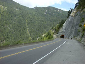 Going
north, we climb grade after grade, yet after each one drop back down to near
river level. In places the
mountainsides are cut with tunnels to allow the road to continue up the valley
(picture left).
There are seven tunnels on this route, ranging from 150m long, to the
China Bar tunnel above Hell's Gate with its curving 700m bore.
The tunnels are worrisome, but fortunately we're away early enough that
the traffic is light and we get through nearly all tunnels with no traffic at
all to bother us.
Going
north, we climb grade after grade, yet after each one drop back down to near
river level. In places the
mountainsides are cut with tunnels to allow the road to continue up the valley
(picture left).
There are seven tunnels on this route, ranging from 150m long, to the
China Bar tunnel above Hell's Gate with its curving 700m bore.
The tunnels are worrisome, but fortunately we're away early enough that
the traffic is light and we get through nearly all tunnels with no traffic at
all to bother us.
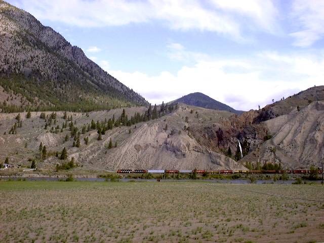
Craig and I stop several times to take pictures - the scenery is stunning. Arriving at Hell's Gate, we decide to have a quick look around, but not to stay and play tourist. Hell's Gate is a canyon through which the Fraser River pumps twice the volume of Niagara Falls. The canyon walls are sheer rock, dropping precipitously more than 100m straight down. Very impressive. After Hell's Gate, we hit the grand-daddy of tunnels -- the China Bar. Checking for traffic and seeing it's all clear, we head in, hammering hard to clear the 700m distance before any traffic comes along. I make it out just ahead of Craig, who gets tooted by a truck, pulls over and stops on the very narrow shoulder strip to let it pass, then gets a thank-you toot from the trucker. So far, all the truckers we've encountered are great. For our own safety, we give them as much room as we can, keeping to the right of the wide shoulder. They swing wide to pass us whenever they've got the room from oncoming traffic, keeping their wind effect minimal as they charge by us.
All along the route, we're flanked by the river and two rail lines, one originally built by CNR and the other by CPR. There are long, long trains in both directions constantly. Regrettably, most of our campsites are along the same valley, so trains are a constant screaming, banging rumble through the night, along with the ever-present truck traffic on the TCH. Fortunately, after the first night I get smart and use earplugs. All I get through them is a pleasant bass rumble of the trains.
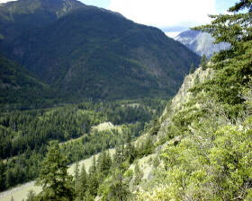
North
of Hell's Gate (picture above left shows Fraser R valley north of Hell's Gate) we pass through Boston Bar and then up the long grade of the pass
through the Lillooet Range of the Coast Mountains -- over the shoulder of
Jackass Mountain (picture above right, at top of pass), backed by the massive bulk of 2,043m Zakwaski
Mountain. The grade is many kilometers long at about 3%.
It's a very long and tiring grind. Stroke,
stroke, stroke and think of Dairy Queen! The
other side of the pass is a 7% downgrade and I coast along in a tuck at 76 km/hr
for a couple of kilometers.
Further
up
the road we enter the town of Lytton, with the confluence of the Fraser and Thompson
rivers. The Fraser is muddy brown,
the Thompson is deep green with glacial runoff.
Where they meet in Lytton, 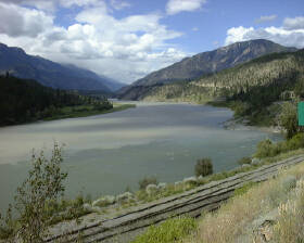 the river shows a swirling line as the two
currents fight each other, much like cream being poured into hot coffee.
the river shows a swirling line as the two
currents fight each other, much like cream being poured into hot coffee.
We
turn to follow the Thompson River valley for another 25km.
Just leaving Lytton, disaster strikes.
My right foot slides off the pedal, and I look down to realize that the
pedal is attached to my shoe, and the pedal spindle is sticking out all alone.
The retaining rings at the end of the needle bearings have fractured,
allowing the pedal body to separate from the spindle.
There's no way to repair it on the road, there's no bicycle shop for
100km in either direction, and we're 25km from camp. What to do? Craig
and Robert have a few suggestions, yet in the end the only manageable recourse
is either plan A: stick the pedal on the spindle and use sidewise leg pressure to keep
it in place and see how far I can get, or plan B: flag down a passing pickup
truck for a ride to camp. "Go
big or go home" wins out. I
jam the pedal on the shaft and start riding. I can't put much downward pressure
on the pedal or it slides outboard and off the spindle.
Pedaling with about 40% effort on the right side and compensating with
more on the left, we continue. The
last 25km to camp is a very long ride at an average speed under
20km/hr.
Despite
the mechanical problems, the change in environment is spectacular.
Following the Thompson River northward puts us behind the screen of the
Lilloet Range, and into "Interior BC".
The lush coniferous forests give way to scrub pine, grasses and
sagebrush. The air is noticeably
drier and hotter, and the wind begins to blow hard, usually from behind us.
The surrounding mountains are not the sharply upthrust and younger peaks
of the Coast Mountains, but the much older folded and heavily eroded interior
ranges. Where the Fraser Valley
seemed all rock, with very little evidence of glacial till, the Thompson Valley
seems carved out of till, with layer upon layer of sands, gravels, and layers of
rounded gneiss, schist and other forms of granite stones.
 The stones are rounded and smooth from being tumbled in glacial melt
flows, and laid down in even-sized layers as the flows slowed and dropped their
loads.
The stones are rounded and smooth from being tumbled in glacial melt
flows, and laid down in even-sized layers as the flows slowed and dropped their
loads.
As
we move north near Spences Bridge, we see massive outcroppings of shale, mixed
with high slopes of sand, clay or gravel. Everything
is huge in scale and awesome to behold.
Finally
we round a bend going up a grade and spot our destination camp.
A small grassy campground nestled on the bank of the Thompson River, with
one train line on the other side of the river, and the highway and the other
train line running on our side, right beside the camp.
I am totally wiped out yet have a mechanical problem to deal with.
I dig out a phone book and start hunting for bicycle shops in the hope
that the magic combination of a credit card and courier service can help me.
No luck! Just as I begin to resign myself to riding in the truck to
Merritt tomorrow, Bruce rides in, and I ask him if he's carrying spare pedals.
Nobody carries spare pedals -- they simply don't break.
Yet, Bruce does! He's
carrying an old pair of Shimano Ultegra SPD pedals, which fit my bike and shoes
like they're made for each other. He
offers them to me until we hit the next bike shop.
The relief is tangible -- after all I came to cycle, not ride in the
truck. Totally exhausted from the
day, I just feel like collapsing, yet there's stuff to do.
I
get my tent pitched, join the others for a great dinner of pasta, salad and
veggie stir fry (should have brought a bigger plate!), then dig into repairing
my bike. Except for having to carve
some rubber off the bottom of my shoes to give the different sized/shaped pedals
enough clearance, the repairs are done quickly.
There's still lots of daylight left, but
I'm bushed. I
get cleaned up, climb into my sleeping bag, and
within seconds I'm gone.
Tomorrow
promises to be fair weather and a shorter ride -- 74 km to Merritt.
Daily
Stats:
Day
temp:
15C in morning, 24C in afternoon, as high as 29C at times in Thompson Valley
Wind:
Varying throughout day; tailwind when it counted going up Jackass Mountain.
Official
distance: 128
km Distance
actually cycled: 133 km
Elevation:
from about 60m at Hope to 220m at the campground.
As high as 330m along the route, with several climbs over 100m and one 7%
downhill. While the net gain in altitude is only 160m, our total climbing
elevation is about 650m. If that
doesn't seem much, consider that that's about a 170 story building!
...alan
Thompson RV Park
Spences Bridge, BC
Day
4: Spences Bridge to Merrit, BC
July 2, 2000
"To
sweep down hills and plunge into valley hollows; to cover as on wings the far
stretches of the road ahead and to find them in bloom at your approach."
Alain Fournier, "The Wanderer"
I'm
up early again, and seeing the still, calm morning, decide to get an early
getaway. Quickly making my PBJs and
grabbing a couple of bananas, and wolfing down a banana covered in peanut
butter, with my tent and everything packed away, I forgo the group breakfast and
hit the road. The solitude is nice
-- what I'm used to in my own riding. At
7 a.m. there's no traffic, no trucks, no wind, and the air is clear.
What a great day to be alive and on a bicycle with good pedals.
Today's route is pretty simple -- we follow the highway along the Nicola River from it's confluence with the Thompson, east-southeast to Merritt. The scenery along the route is spectacular, as only photos can really show. The land is like mountainous desert (see picture below).
The vegetation is very
sparse, giving way to coarse grass and sagebrush.
The immediate slopes are glacial till - vast reaches of sand and gravel,
while the upper slopes are old fold, rounded interior mountains.
It's all so awesome to feel so small and insignificant compared to such
vastness, yet so inspiring to be able to do this at a level that I can see,
smell and feel the land around me.
The Nicola River is a small one, rapidly tumbling along its gravel bed, green in colour and very cold. At 9:20 a.m., after about two hours of cycling with occasional stops to take photos, I stop at the top of a long grade and sit on an outcropping where I can see for perhaps 10 km in either direction down the valley, and down to the valley floor and river about 100m below. I've just passed through 400m in elevation. Earlier on, I thought I was feeling quite sluggish since the bike wasn't flowing down the road like it usually does. Watching my GPS, I noted that the elevation was climbing slowly, meter by meter. I thought I was on the flat, when the road was actually one continuous slight grade. The road winds serpent-like up the valley with the river, with long undulating switchbacks, yet the overall grade is up and up.
Just
finishing my first lunch and getting back on my bike, I spot Jon chugging over the
hill, and we ride on together, enjoying the scenery. It isn't long before Brook drives by in the truck on her way
to Merritt and some grocery shopping for us.
A
little while later we come to a BC provincial campsite and sit beside the river for a
second lunch. On the road a minute
or two later, we're startled by a crossing deer who, seeing us, charges away
down the slope and across the fields, bounding like a kangaroo.
Fifteen
kilometers from Merritt, we pass a house with a sign outside that says,
"Welcome Tour du Canada". A
group of children are selling Gatorade and freshly homemade blueberry muffins!
Who can resist? Not us!
Back
on the road and 15 km to go. The
wind has been stirring, and has now settled into a steady south blow, picking up
strength quickly. By the time we head down the final 6 km south into Merritt,
the wind is in our faces and we're struggling to keep our pace.
 Arriving
at the campground at about 11:45 a.m., there's no sign of Brook and the truck.
Jon decides to relax in a sunny spot, while I head back into town to find
the bike store. As expected, it's
closed and the owner, whose name I got from the kids at the blueberry muffin
stop, is not around - he's out mountain biking.
No luck on pedals today --I'll try in Kamloops as we pass through
tomorrow. But I do run into Brook
in the parking lot of the grocery store, and I go in to get some juice, and
crazy glue. I've joined the mascot
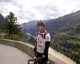
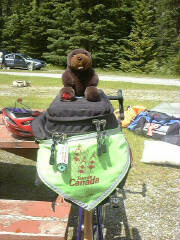
contest with a little stuffed beaver I picked up at Hell's Gate.
"Bucky" gets glued to the rear pack on my bike (picture right), and will be my
mascot for crossing the rest of the country.
Yes, the beaver is a noble animal, and this is a noble quest.
Bucky and I will be quite proud of our accomplishments.
Arriving
at the campground at about 11:45 a.m., there's no sign of Brook and the truck.
Jon decides to relax in a sunny spot, while I head back into town to find
the bike store. As expected, it's
closed and the owner, whose name I got from the kids at the blueberry muffin
stop, is not around - he's out mountain biking.
No luck on pedals today --I'll try in Kamloops as we pass through
tomorrow. But I do run into Brook
in the parking lot of the grocery store, and I go in to get some juice, and
crazy glue. I've joined the mascot
contest with a little stuffed beaver I picked up at Hell's Gate.
"Bucky" gets glued to the rear pack on my bike (picture right), and will be my
mascot for crossing the rest of the country.
Yes, the beaver is a noble animal, and this is a noble quest.
Bucky and I will be quite proud of our accomplishments.
After
a shower and some laundry, it's time for our galley crew to go to work on dinner.
We prepare Waldorf salad and a massive stir fry with rice. Thirty cups of
cooked rice disappear into hungry cyclists, along with ice cream from Brook and
fresh strawberries from Tacia. What
a feast. Then I sit shivering at a
picnic table until 9:30 p.m. (it's about 10ºC out here!) finishing last night's
journal and today's. Now, off to a
warm sleeping bag to dream about tomorrow's big hills on the way to Kamloops and
beyond.
Daily
Stats:
Day
temp:
14C in morning, 20C in afternoon, cooling to 15C in late afternoon as wind
starts to howl
Official
distance: 76
km Distance
actually cycled: 77.3 km
Cycling
time: 3:20
Trip time: 4:40
Avg speed: 23.2 Cumulative
distance: 417 km
Elevation:
from 220m at Spences Bridge to 600m at Merritt.
Net gain of 380m, total climb of about 650m like yesterday.
..alan
Claybanks RV Park
Merritt, BC
Day
5: Merritt to Pritchard, BC
July 3, 2000
"If
the wind is not against you it is not blowing." James Starrs
On
breakfast duty this morning, Bliss and I were up to get the coffee and oatmeal
started at 5:00 a.m. It was 7ºC
this morning -- very cold. Karin and Jules joined us shortly to add scrambled
eggs to the menu. Cooking for 24
hungry people is not an easy task. The
first two nights on the road, quantities were underestimated and additional
cooking was needed so that everyone ate well.
This morning we go through a huge vat of oatmeal and about 75 eggs.
By the time breakfast's done and cleaned up, and the truck packed, our
last group cycles out of Merritt at 7:50 a.m., hitting the highway to Kamloops.
I'm
riding with Karin, John, Jules and Dave and learning to ride in a double paceline.
This feels like being a real cyclist, tooling along with little effort at 30
km/hr. We're constantly rotating
the lead in a clockwise pattern, with riders moving up on the outside column and
falling back
on the inside column. This means nobody
has to lead for long at a time, and most of the time is spent riding in someone
else's wind shadow. Riding
"caboose" at the very end of the formation is like coasting. At around 30 km/hr, about 30% of the riding effort goes into
wind resistance; this is why the paceline is so efficient.
We're
riding up hwy 5A which used to be the Trans-Canada highway before the Coquihalla
expressway was built. 5A runs up
the east side of Douglas Lake, and the new Coquihalla Expressway runs along the
west side. Our side has next to no
traffic, and the pavement is in pretty good shape. Douglas Lake is an alpine lake that's one to three km wide
and about 35 km north to south. It's
quiet -- only a few loons, ducks and fishing boats.
No powerboats, no cottages, no jetskis -- this is really nice. 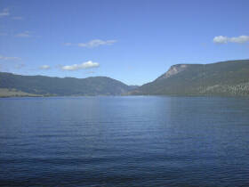
After
about 30 minutes of cycling we're nicely warmed up and we stop to take off our
jackets and stretch out before continuing.
Not much further up the highway, the group decides to turn off the road
to check out a historic site, and I keep going. I'm feeling great, the day is glorious, and the scenery, once
again, is almost overpowering in it's vastness and beauty.
It takes about an hour to cycle the length of Douglas Lake, following the
shoreline all the way, and stopping to take a couple of pictures.
Not
far beyond Douglas Lake, I overtake Carol and Bruce, who left camp earlier than
I, and who have been taking a more leisurely pace. A few hundred meters down the road we spot a bald eagle
perched in the top of a dead lodgepole pine beside the road. The occasional passing car or truck doesn't even make it flinch as it surveys the landscape.
A German family has stopped as well, and we chat for a few minutes.
They're on a five week road trip through Alberta, BC and Washington.
I take a couple of pictures and hit the road again.
This is ranching country --
not quite as dry as the lower stretches of the Nicola Valley yesterday, there is
lots of grass carpeting the mountain slopes. We pass Douglas Ranch, billed as the largest working
cattle ranch in North America!
I
leave Carol and Bruce behind and continue on at my own pace.
Through a series of very gently sloping switchbacks, I've now climbed up
to 745m altitude, and follow the road around part of Stump Lake.
This small lake has a surface like a
mirror, 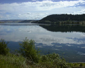 reflecting the cliffs and clouds perfectly.
Again I stop for pictures. (see
left) A
few rolling rises later, I'm at 800m for the first time on the trip.
Overtaking Keith, we cycle together for a while over yet more rolling
hills. Leaving Keith behind, I'm
feeling really good now -- I'm relaxed, spinning an easy and constant 90 rpm,
shifting as necessary to keep the cadence as constant as possible, and breathing
easily. This is a nice aerobic pace
that feels like it could last forever, just like the mountains and valleys seem
to stretch out forever. I've got
four bananas with me for today's long ride, and I slow down every once in a
while and eat one while continuing to ride.
Eating like this, coupled with the 125 oz of diluted Gatorade mix I carry
in my Camelbak and water bottles, keeps me fueled for riding throughout the day.
reflecting the cliffs and clouds perfectly.
Again I stop for pictures. (see
left) A
few rolling rises later, I'm at 800m for the first time on the trip.
Overtaking Keith, we cycle together for a while over yet more rolling
hills. Leaving Keith behind, I'm
feeling really good now -- I'm relaxed, spinning an easy and constant 90 rpm,
shifting as necessary to keep the cadence as constant as possible, and breathing
easily. This is a nice aerobic pace
that feels like it could last forever, just like the mountains and valleys seem
to stretch out forever. I've got
four bananas with me for today's long ride, and I slow down every once in a
while and eat one while continuing to ride.
Eating like this, coupled with the 125 oz of diluted Gatorade mix I carry
in my Camelbak and water bottles, keeps me fueled for riding throughout the day.
About
85 km into today's 142 km ride, I come across Robert and Eric at the side of the
road. Eric's bottom bracket seems
to be on the verge of failing, and his left pedal crank is out of alignment.
Brook hasn't passed by in the truck yet, so they're waiting for her to
allow Eric to get his tools out of the truck to make repairs.
This isn't the sort of repair one contemplates ever needing to do,
especially on the road! I stop to
wait with them and we have some PBJ lunch together.
Knowing that Brook will be by shortly, I continue on and hit the
grandaddy hill for the day.
This
hill climbs to the top of the ridge to the south of Kamloops.
The tough part of this hill is only a kilometer or so long, yet the total
altitude gain is 200m,
from 700m at the bottom to 900m at the top.
The middle section is quite steep -- at least a 12% grade.
This is huff'n'puff time as I stand up and slowly grind to the top,
heartrate running well into the anaerobic zone with lots of hill left to go.
This is one tough sucker -- much tougher than any of the hills so far on
this Tour. 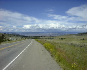
Over
the crest and onto a plateau area, I can see a huge valley in the distance in
which I know I'll find Kamloops. (picture
right) Cycling
along the plateau, I overtake a group of three mountain bikers returning from a
ride. Chatting with them, I get directions to a couple of bicycle shops in
Kamloops -- I still need new pedals.
The
plateau ends with a brake-check pullout stop for truckers before plunging down
the Kamloops valley. I let gravity
do what it's supposed to do, tuck down, and coast for several kilometers at 74
km/hr as we descend 375m to the Trans-Canada highway running east and west to
the south of the city. I actually have to
brake because the crosswinds are somewhat gusty, and I'm not confident of my
bike handling ability at very high speeds in crosswinds. Heading for
bike shops downtown, I ride with the traffic, descending another 150m to the
city centre, only to find both bike shops closed for the holiday.
That means I have to climb back up 150m to the Trans-Canada level again
-- @#$$#! This is a very steep
climb -- about a 7% grade in spots. The
ol' quads are getting a little burnt by now.
After
asking directions, I find Java Cycle -- a combination mountain bicycle store and
coffee shop. Really cool.
In the store I run into Eric and Robert.
Brook dropped off Eric and
his bike here for repairs. While in
the store, Craig and Keith arrive too. It's
a Tour du Canada party! I'm after
pedals, but James Jeffries, the proprietor, points out that this is a mountain
bike store, and he has no parts stock specifically for road bikes.
However, he pulls out a pair of Shimano new-model top-end SPD pedals that
will fit my bike and shoes just fine. They're
no heavier that the Ultegra pair I'm looking for, and have the advantage of
having clips on the top and bottom of each pedal -- this makes getting into
them a snap in tough situations (traffic lights, on hills, etc).
After a bit of negotiation, James sells them to me at the same discount
he gives the "A team" that Java sponsors. We also enjoy some oatmeal cookies while Eric's bike is being
repaired. Eric is clearly relieved
that his bike is indeed easily repairable, and he's able to continue on the tour
without further delay.
Keith has already left, and now I leave Java Cycle too, with Eric and Robert still to follow. If you're ever in Kamloops and need a great bike shop, check out Java Cycle on Summit Dr just off the junction of 5A and the Trans-Canada. It's right on the TDC route - not hard to spot.
Joining
the traffic merging onto the Trans-Canada, I run into Bliss and Daphne, and we
decide to stop at Tim Horton's at the bottom of the long descent ahead.
Again I left gravity do what it does best as I coast at 60 km/hr down
another 170m descent, and take a side exit to Tim's.
Enjoying a coffee and donuts, we chat with a young couple on their way home
from a mountain bike event. Like
everyone we meet, they're really taken by the notion of a rag-tag group of
individuals cycling across Canada together.
This is really cool!
Bliss
and Daphne need to make a phone call, so I hit the highway without them.
I'm now riding due east out of Kamloops along the Trans-Canada highway.
It's a four-lane highway with a paved shoulder as wide as a lane.
While the traffic's extremely heavy, there's lots of room on the shoulder
for bikes. After a while, I catch
up with Kelly, Eric, Sue and Craig, pass them and keep going at my own pace.
A little while later I catch up with Bruce M (Dr. Shimano) and we talk
about pedals, bike shops and so on as we spin along at a nice easy 28 km/hr. Bruce falls behind and Craig catches up to me and we ride the
rest of the way together.
At
one point, Craig stops to adjust his shoes, and I slow down a bit but keep going
-- Craig will catch up within a few kilometers. Passing a couple of police officers running a radar trap, I
stop to chat. They clock me
coasting in at a leisurely 23 km/hr. When
Craig comes along, they clock him at our more usual 30 km/hr. They say that the traffic will be noticeably lighter tomorrow
when the holiday rush is over, and wish us luck on our journey.
Craig
and I spin the remaining few kilometers to Pritchard, and another 6 or 7 beyond
to the Ponderosa Pines Campground. There
we get the usual round of applause from those already in camp -- everyone except
the first in get greeted this way, and it really feels good.
Each day, after all, is quite an accomplishment.
Then
it's into camp routine: pitch tent, check bike and make repairs as needed, put
on my new pedals and give Bruce his back, do some laundry, have dinner, fill up
my Gatorade containers for tomorrow, have a shower, and finally, index my
pictures and complete this journal. At
10:30pm, it's later than usual, and I want to get an early start tomorrow for
the 112 km ride along the Trans-Canada to Sicamous and our rest day.
An early start guarantees lighter traffic and, usually, no wind.
Lights out.
Daily
Stats:
Day
temp:
...alan
Ponderosa
Pines Campground
Pritchard,
BC
Day
6: Pritchard to Sicamous, BC
"Just
remember, when you're over the hill, you begin to pick up speed."
Charles Schultz
It's
July 5th, don't know what day of the week, but it's a rest day, and today that's
all that counts. Yesterday was my
birthday, and also a day to try one's cycling soul.
Yeserday,
day
6 dawned overcast, with the mountain tops hidden in pregnant clouds waiting to
dump on us. As I lay in my sleeping
bag, I tried to convince myself that the pit, pit, pit sound was mosquitos,
kamikazi dive bombing my tent fly. No
such luck -- it was raindrops. That
was just a shot across the bow however, and the rain held off while we had
french toast for breakfast, and packed up camp.
Karl,
Craig and I left the camp at 6:50 a.m., before most of others, hitting the TCH
(Trans-Canada Highway) eastbound towards Salmon Arm, 68km away.
As yesterday, we found the TCH easy to ride on. The very wide paved
shoulder had little debris on it, and we made good time.
The hills on the TCH tend to be very long grades, rather than the rolling
and steeper hills we've seen on the secondary highways.
15km into the ride we ride up a typical grade that rises 87m in 1.4km.
That rise is about a 20 story office building -- it's a 6.2% grade.
Yep, this is "typical".
At
about 27km into the ride we stop for pictures along scenic Shuswap Lake.  This lake supposedly has about 1600 km of shoreline along its great
length, many arms, inlets and bays. Tightly
framed by mountains, it's truly beautiful in the dull grey morning light, with
scudding clouds blowing along the valley below mountain top height.
This lake supposedly has about 1600 km of shoreline along its great
length, many arms, inlets and bays. Tightly
framed by mountains, it's truly beautiful in the dull grey morning light, with
scudding clouds blowing along the valley below mountain top height.
About
40 km into the ride, still 28 km from Salmon Arm, we're getting chilled, but the
rain has held off so far. We pull
off the road at a highway restaurant overlooking Shuswap Lake for coffee
and muffins. While we're there for
an hour warming up and talking, the waitress keeps filling our coffee cups over
and over again. This will turn out
to be a bad thing as well. While
there, Robert and Neri both join us to get warmed up.
Leaving the restaurant, we hit the road again just as the rain starts. Once it does start, we can't really tell whether it's raining, or how hard, since we're soaking wet and repeatedly drenched in spray and road grit from passing trucks and the back wheel of whoever's bicycle is in front of us. The good news about pacelines is that they're efficient. The bad news is that in wet weather, you eat whatever the tire in front of you kicks up. The temperature also drops 3ºC, down to 9ºC, as the cold front moves through. Now I'm wet, cold and covered with road grit. The kilometers pass by as, with heads down, we grind on towards Salmon Arm. Rounding a turn in the highway, we look down a long grade with highway construction. This adds mud to the rain, cold and road grit. Now my front, from head to toe, is covered with dirt, grit and mud. Oh yeah, this is real fun this is!!
I'd been warned that this trip could be 90% physical and the
other half mental, and now the mental challenge is at full force.
Digging deep into images of better rides on better days tucked away for
situations just like this, I'm able to keep the legs pumping.
I also learn a good lesson -- at home on a training ride, when conditions
get like this, I can either just turn around and go home, or at least look
forward to getting home. Out here,
I have only one option, and that's to keep going to get to camp.
I didn't bring enough extra layers to wear on today's ride, and my
shivering is evidence that I'm now paying
the price of the lesson.
Finally
riding into Salmon Arm, Craig, Robert and I are on the lookout for Karl's
bicycle outside a restaurant. Karl
had gone on ahead at his own pace, partly to keep warm, and we'd agreed to meet
up later. As well, we'd run into Bruce M, sitting in the rain, on the shoulder of the TCH, fixing yet another flat
tire. He said he was okay, so we'd
continued on, agreeing to meet at Tim Horton's in Salmon Arm.
I've
visited a lot of Tim Horton's locations over the years, and while they're all the
same, none was ever so inviting as
this one is right here and now. We look a sorry lot to
those inside as we wheel up on our bikes and park them in the rain on the patio area.
Craig takes my picture before we go inside (picture below right), and I shake the tree over us
to shower off some road grit.  We each have some hot soup and coffee, and make use of the hand dryer in
the washroom to dry out gloves and jackets, at least a little.
Bruce M comes along and joins us, telling us that after fixing the
flat out on the TCH, he'd just started riding again when his back tire flatted
yet another time! This man is truly
jinxed it seems.
We each have some hot soup and coffee, and make use of the hand dryer in
the washroom to dry out gloves and jackets, at least a little.
Bruce M comes along and joins us, telling us that after fixing the
flat out on the TCH, he'd just started riding again when his back tire flatted
yet another time! This man is truly
jinxed it seems.
Departing
Tim's after an hour, our tired damp bodies are immediately chilled as we hit the
road. Fortunately, there's a 5%
grade to climb out of Salmon Arm that warms us up. While
the rain has stopped, it's still cold, and we're feeling pretty drained.
At the top of the grade, Robert realizes he's left his glasses in Tim's,
so off he goes back down the hill to retrieve them, while Craig and I keep going
just fast enough to generate body heat. We wait for Robert at a gas station,
inside where it's warm, until he catches up to us again.
A
few kilometers later, we leave the TCH to take 97B southeast.
This takes us through some hilly country and then down a very long and
steep descent into the northern reaches of the Okanagan Valley just south of
Grindrod. The surroundings have
changed yet again. Even this far north, the Okanagan is decidedly more lush
than other areas we've just come through. Around
86 km into the ride, we stop at a roadside store for chocolate bars, and eat some
more of our bananas and PBJs for lunch.
By
now the legs are feeling like jelly -- there's simply no resiliency left to
tackle any hills. Also, my calf
muscles seem on the verge of cramping on the hills, which is unusual.
Coupling with a craving for potato chips (which I didn't buy in that last
store), I realize that in drinking all the coffee at the last two long stops, my
thirst has been quenched, but I've only consumed about half the Gatorade mix I
should have to this point. My leg muscles are showing the result of too little
replacement of salts. This
is easily cured -- I start drinking and drinking, yet it's a little late to help
much for the remainder of today's ride.
 We
ride north from Grindrod, northbound to the very apex of the Okananagan Valley
-- Sicamous is our destination. Sicamous
is the northern gateway from the TCH to the Okanagan, with Vernon, Kelowna and
Penticton many kilometers south from where we are.
At this point the south wind becomes a tailwind, helping us a bit.
We
ride north from Grindrod, northbound to the very apex of the Okananagan Valley
-- Sicamous is our destination. Sicamous
is the northern gateway from the TCH to the Okanagan, with Vernon, Kelowna and
Penticton many kilometers south from where we are.
At this point the south wind becomes a tailwind, helping us a bit.
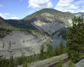
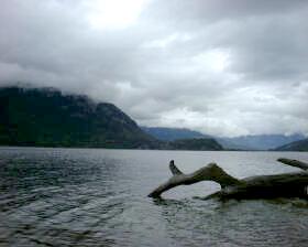
Now we're cycling up the eastern shore of Mara Lake, yet another very long and narrow valley lake, nestled in heavily-wooded mountain slopes on either side. (picture left)
Finally,
after 115 km, we pull into Shoreline Resort, our campground for two nights.
I'm cold right through, exhausted and having trouble walking on legs of
jelly. I've learned lessons today
about being prepared for different weather conditions during a ride, about being
careful what I eat and drink along the way, and about fluid and electrolyte
replacement. It's taken us 4:36
riding time, but we've been on the road for 7:40 -- just another workday on Tour
du Canada.
In
camp, we meet up with the group who left Vancouver a day ahead of us.
We'll see them for one night each rest day, as we overlap for one night.
They've been having pretty much the same weather as us, and the same
experiences, although I must say that I think our group seems to be having more
fun together.
Karl
has been in camp for a while, and helps me pitch my tent, which is much
appreciated at this point. 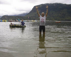 Before heading for a hot shower, and despite the
cold, the beach and lake are far too inviting, and I decide I need at least a brief dip. For proof, I ask
Karl to snap a few pictures (see right), and into the lake I go with my cycling clothes on.
It's icy, icy cold, yet somehow it doesn't matter.
Running out, it's straight to a steaming hot shower, where I could stand
forever as the heat seeps into my bones.
Before heading for a hot shower, and despite the
cold, the beach and lake are far too inviting, and I decide I need at least a brief dip. For proof, I ask
Karl to snap a few pictures (see right), and into the lake I go with my cycling clothes on.
It's icy, icy cold, yet somehow it doesn't matter.
Running out, it's straight to a steaming hot shower, where I could stand
forever as the heat seeps into my bones.
This
weather is so variable it's amazing in itself. The locals say that it should be
30C here this week. It's an unusually
cold summer so far. We hear on the news that
Merritt, where we were the day before yesterday, got 15 cm of snow this morning!
Brrrrr!!
After
getting cleaned up, and feeling warmer, I call home and talk to C for a
while. It's good to hear her voice,
even though it's only been a day since we've talked. She wishes me a happy birthday, as does L when I call
her. L and I talk about meeting
in
Golden and, while I haven't seen her since April and very much want to, the
reality of the situation doesn't make sense.
Our ride into Golden is a long day with lots of hills (over Roger's
Pass). We'll get into camp late, and there doesn't seem to be enough
time before bedtime to get everything done to be ready for the next day.
For L to drive two hours each way, leaving Cranbrook around 4pm, just
doesn't seem to make sense. Regrettably,
we agree.
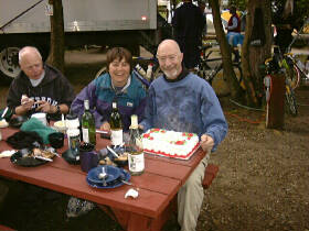 For
dinner, gourmet chef Bruce M is leading his galley crew in preparing a stunning
feast of chicken, rice and split-pea soup.
What a feast! Karl took a 10
km detour today and picked up
some wine at a local winery, so we've got wine as well!
The meal is made all the more special with the surprise of a birthday
cake for me and my bike mascot Bucky the Beaver, and yet another round of
"happy birthday" singing -- the third time today!
After supper is cleaned up, we head to the beach to set off some
fireworks and sing the American anthem for Karl, our friend from New Hampshire.
For
dinner, gourmet chef Bruce M is leading his galley crew in preparing a stunning
feast of chicken, rice and split-pea soup.
What a feast! Karl took a 10
km detour today and picked up
some wine at a local winery, so we've got wine as well!
The meal is made all the more special with the surprise of a birthday
cake for me and my bike mascot Bucky the Beaver, and yet another round of
"happy birthday" singing -- the third time today!
After supper is cleaned up, we head to the beach to set off some
fireworks and sing the American anthem for Karl, our friend from New Hampshire.
We
don't have to get up on the rest day, and take advantage of it by heading out to
a local pub. Moose Mulligans is the
spot, where we sample a few pitchers of different local brews (Okanagan Spring
Pale Ale being my new favourite). My friends give me a chaser of "Moose
Droppings" - a strong concoction served in a straight-up shot glass with
chocolate chip "droppings" in the bottom - and the house gives me a
celebratory shot of strawberry tequila. After
the physical experience of the day, all this is a bit much, and the 15 minute
walk back to camp is a bit of a blur.
Day
7 (July 5): Sleeping
in until 6 a.m., I'm awakened by the group ahead of us that's leaving today. They're
up and about, breaking camp and making breakfast, getting ready to hit the road.
In our group today, some are going ATV riding, Kelly's going canoeing, and most
of us have bikes to clean from yesterday, bike repairs to make, laundry to do,
journals to catch up on (like this one!), and postcards to write.
Despite the long list of things needing to be done, this rest day is a
welcome event. I'm sure I'll be
recharged and ready to ride tomorrow. I'd
better be -- ahead of us lie the Monashee Range, Roger's Pass and then the Kicking
Horse Pass over the Rockies. Lots of
climbing to come as we look forward to Albert Canyon, Golden, Field, Banff, and
then out of the mountains to Drumheller for our next rest stop.
That's where I'm likely to find the next place to plug in my modem, so until
then, goodbye.
Daily
Stats:
Day
temp:
Quote
for rest day: "Cleaning
a bike's like cleaning a toilet. If
you do it regularly, it's fine and easy. If you wait, it's a truly disgusting
experience." Steve Gravenites,
pro bike mechanic
...alan
Shoreline
Resort, Mara Lake
Northern
tip of Okanagan Valley,
Sicamous,
BC
Welcome > Coast Mountains > Over the Rockies